Tag Archives: Sunset

A Large Accomplishment On The Bucket List!

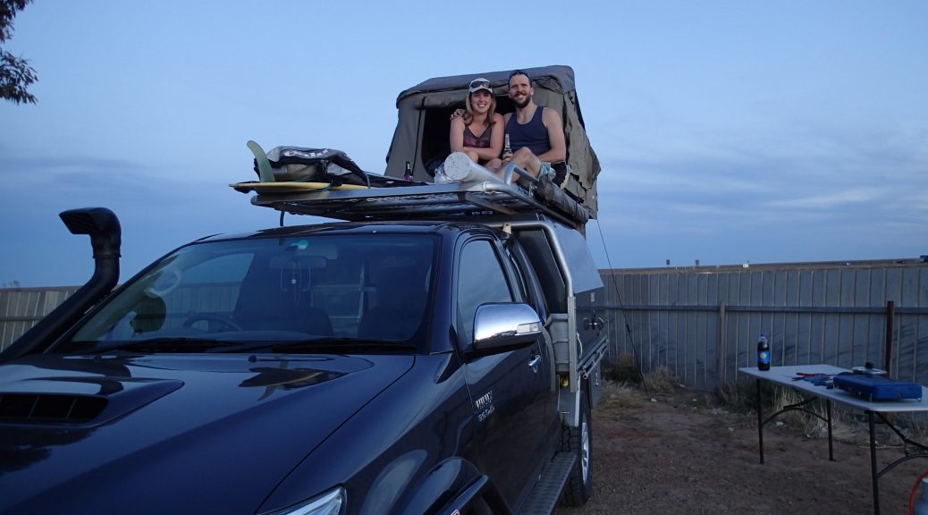
As Nay had just finished preparing dinner there were the torches of two complete strangers appearing only meters away from camp.  The figures of two Italian tourists came out of the shadows and through broken english, explained they were stuck 2kms away on the 5 Beaches loop.  Being 7:00pm with dinner ready, we explained it was best to help them in the morning and that they should have stayed with their car.  Disgruntled by our response they went back to spend the night in their rooftop tent awaiting our rescue in the morning.

As we woke with the sunrise, our Italian friends were at our doorstep bang on 7:00am!  Stunned at why they were there they insisted we helped them immediately (circumstance still being the same as last night).  Explaining we would be there within an hour they strolled off and requested the help of another camper without notice.  After a quick pack up we followed their trail to find the other camper pulling the bloody tourists out.  Scratching his head, the fellow Aussie camper wandered why he was called upon when we were already teed up.  Regardless, he helped the tourists and the three of us even earnt $20 for our troubles!  Dreams can come true!

From the Croc Tent’s recommendation we continued along the 5 beaches track with its breathtaking views.  Being so early, we had it all to ourselves.  With an untouched sand canvas, we could not resist doing doughnuts while the ocean sat at low tide.  It felt unbelievably remote as the only tracks in the sand we came across was that of a few wild pigs.  Deciding to have a bit of fun Stu shot up a soft sand dune with Woody but couldn’t continue along the track as we hadn’t dropped our tyre pressure.  Mark’s turn with Buzz, lead to him becoming seriously bogged at the top of the dune.  Another quick recovery lesson with Stu and the cavilary was called in to snatch him out.  

Once our couple of nights at Somerset were up, we were back in the trucks and aiming for Pajinka (The Tip).  Excitement kicked in as it was still so unreal to put our current position on the map in perspective.  Pulling up in the carpark we still had a 700m walk before our final destination!  Sounding a short distance, this took quite a toll on us since we had completed minimal walks over the last month or so.

As the edge was nearing the signposted goal was visible and only steps away!  Just as a family left we had our time at the top of Australia!!  We’d made it!  We spent a while here taking silly selfies and carving ‘Buzz and Woody 2016’ on some nearby rocks.  Mark even took the liberty to take a wizz off the top of Australia!  Once our cameras were full of wacky and zany images (a couple half decent) we made the slow climb back down to Buzz & Woody.

After achieving such a great accomplishment, we checked out the deminishing old Pajinka Lodge.  It was a rundown Aboriginal owned lodge at ‘The Tip’ which ended up not being very successful and shutdown around 2010.  Reminding us of a scene from horror movies, the desolate, left for dead buildings gave a slight chill down the spine.

Being cheap petrol Thursdays (saving 10c/L!) we filled up at Bamaga.  With savings in our pocket, we went exploring to see if the Loyalty Beach Campground lived up to its magical reputation.  We couldn’t argue with the reviews.  Great bushcamping with no designated camp spots, we pulled up along the coast with a perfect view of the sunset!  We could finally have a proper shower to scrub off the grime that had been accumulating since Cairns.  With this added bonus, we wandered down to the beachfront bar for an icy cold stubby.  It was a stunning sight to watch the sunset over the ocean with the silhouette of the Torres Strait Islands.

In the days prior, we had swung by the small town of Seisia and checked out the wharf to where our next destination lay.  Researching the timetable at Peddels, we booked in for the 8:00 ferry to take us to Thursday Island.  Here we were to meet some of Mark’s extended family.  We were to have one hell of an adventure…

​01/09/2016 – 03/09/2016

The Magical Magnetic Island

Arriving late onto Magnetic Island we drove off the Fantasea Ferry and made our way along a dark windy road until reaching the Bungalow Bay Koala Village.  As the sun slowly came up over the horizon, we were up and out of the camper with the excitement of seeing this new area.  Being here for a few days away from the mainland made this short stint on the island feel like a holiday from the holiday!  We made our way over to Picnic Bay (on the south end) and went for a stroll along the jetty to found ourselves with a magnificant view of tropical fish without even having to snorkel.  The water was an amazing torquoise and crystal clear!  We then stumbled across a rough walking track on the way back.  Along this, we had great views of Picnic Bay and a steep decent lead to a small hidden cove.

image

That afternoon we ventured down a bumpy 4×4 road that lead to more secluded beaches.  A small walking track and boom!  Trees opened up to the stunning Florence Bay with no more than 20 people.  We had a late lunch here and even snuck in some cheeky beers ( a little crab mate was keen to get in on the action too!)  Once properly nourished, we threw the snorkels on and went for a paddle off the beach to a small reef.  As we entered the water, we realised there was no escaping home as Nay bumped into a work colleage from a school in Ringwood as he had just finished snorkelling!  As the afternoon slipped away from us we just lazed in the sun after being mesmerized by the tropical fish we’d seen and took the opportunity to continue the hard work on Brook.

We freshened up back at camp and went for a leisurely stroll with some travellers to watch the sunset over Horshoe Bay.  With our mat set up, we watched the world pass as small boats came in and out from their yachts and drunken locals provided entertainment.  One pretended to be a pirate and walked around yelling “Arrrrggghh!” to everyone and in doing so a classy elderly lady calmly replied “Are.”

image

The next day we thought some exercise was in order and went to have a look at The Forts which had a major role in World War 2 for this area.  A 4.2km walk took us through the camps where signs were scattered along the path with detailed descriptions on each building.  Arriving at the actual Forts section, these buildings were very much intact and great to walk around.  The Command Centre and Telecomms Post were at the highest points which had plenty of information and all very accessible with fantastic 300 degree views of the ocean.  Just down the hill from these buildings were the gun emplacements.  These guns, each weighing over 10 tonnes, were hauled up the mountain by a tractor from Horseshoe Bay back in 1942.  The fascinating fact is that these two giant guns somehow disappeared without a trace once the war was over.

image

The rest of our time here we spent repeating several of our favourite past activities.  We went snorkelling again at Arthur Bay and this time, to our luck, we saw a sea turtle who calming went swimming around us!  Travelling over to the west side of the island we discovered another beautiful beach to watch the sunset over the ocean.  This lead to our final day of clearing out of the Koala Village and having a browse at the local market at Horseshoe Bay.  With a why not attitude, we took the walk over to Balding Bay (a nude beach) for some giggles and spent the arvo here being very free!  The inevitable moment had arrived and the ferry back to townsville was sadly calling us.

image

Overall, we had one of the best few days on Maggie and felt very rejuvinated after the busy loop.  It had places for everyone, great beaches for snorkelling, peaceful beaches for swimming and even a couple for the keen fisherman.  The next week was going to be a different chapter again as the ocean disappeared and fresh waterholes and falls were on the horizon…

Along the MacDonnell Ranges

As we drove into the far west end of the MacDonnell Ranges, the scenery before our eyes changed again.  The landscape was filled with a variety of greens and mountain ranges coated in spinifex, had formed on either side of the highway.  Now, we had both learnt a lot about spinifex over the information boards we read, a very interesting plant which thrives in desert conditions and has a root system 10m deep so it could reach a suitable water source.  All kinds of wildlife are dependant on these plants for shelter and protection in their day to day lives.  The first night we dropped in on a riverbed camp spot where we met another two couples.  We enjoyed some delightful beverages in front of the fire and shared stories from the past and future adventures we were to experience.  Lets not lie… it did get a little out of control!
A local spinifex shrub and its MacDonnell Ranges habitat

image

As an overall sum up of the ranges, you would call it a “mixed bag” of adventures.  We spent a good few days in here and each gorge or site had things to do for everyone.  Starting at the far west end we had Redbank Gorge.  We were informed by the info sign to bring an inflatable mattress to enjoy the float down the gorge.  Not knowing what to expect we reluctantly spent 15 mins in stinking hot weather blowing up the lilo.  Then carrying the lilo for further 20 minute walk in, we hoped it was worth it.  Well it was!  We spent a good 45 mins – 1hr floating down the beautiful gorge where some areas were as narrow as 600mm and others as wide as a car.  Light trickled in to bounce off spectacular cuts in the cliff edges which were a variety of colours.  We  also passed many a happy (We all know frogs go “La Di Da Di Da!!”) and well camouflaged frogs along the way.  Starting to get bloody cold we had to turn back with the unknown of how far the gorge would last..

image

As we traveled further east we dropped in on a few sandy gorges with great big waterholes.  Others were just lovely walking tracks to smaller gorges and an abundance of other treks from there.  Each turn off down the main drag was also scattered with history and local knowledge of what the place means to the Aboriginal people.  An example of this were the Ochre Pits.  A short 300m walk to the info board and it had all the knowledge on a substance we never knew existed.  Mined in only a few places around Australia (including the MacDonnell Ranges), Ochre is still used today in many traditional ways including medicinal needs and body paint.  After writing words on rocks and drawing on each other with this chalk like substance, we moved on to the next place of mystery.

image

As we headed towards the far east end getting closer to Alice Springs we came across more luxurious hideaways, deep water holes and little slices of paradise.  You could easily forget you were once driving through a baron desert..

Exploration of a King!

As the adventure continued from Uluru, we once again made it back on the highway up north to our next destination, Kings Canyon. We camped in another excellent bushcamp rest area (starting to realise NT dominate in this market) where once again had unwanted neighbours drop in on us. All set up facing what we thought was the bush, a family decided to roll up late and camp about 5m right in front of us on the side of a track and ruined our privacy. While we were trying to eat our romantic dinner for two, one of the kids decided to shine his torch right in our faces which obviously the parents thought was fine! On a good note, we were able to use our shower tent and had the first battery powered shower for the trip!

The next day brought the exploration of Kings Canyon. In the morning, after ducking into Kathleen Springs for a stroll down the beautiful and historically rich valley to see the old stockade, we made a late arrival at Kings Canyon. Full spirited we began the 6.7km walk (not reccommended at this stage of the day!) up and along the rim of the Canyon. Absolutely spectacular. The walk took us up and along cliffs, down the valley, into the peaceful Garden of Eden (rainforest like waterhole), and back along the opposing side until we were lead back to the carpark. I don’t think we could of finished the last of the trip quick enough. As we were approaching 3:00pm we were buggered, smashing through the kms, guzzling as much water as we could and wiping the sweat off our brows. Even with a difficult conclusion, we conquered it with smiles and could only laugh at the end with recommendations to never start a walk that large, that late in the day.

2016-04-24_22.09.12

Interesting Historic Fact..

The palm in this below picture is somewhere between 350-400 years old!! These Cycads were scientifically proven to be around back in the dinosaur age!

OLYMPUS DIGITAL CAMERA

Once we had a few lolly snakes and recovered, we jumped in the car and made it to the servo before the Mereenie Loop (an unsealed road joining Kings Canyon, Hermannsburg and the MacDonnell Ranges). This is unfortunately a permit road as it is on Aboriginal Country. We decided the $5.50 for the permit was a lot cheaper than a $1000 fine if caught without one!! We ended up camping at Morris Pass Lookout which is situated on the Aboriginal section of the loop. As we arrived we were welcomed by a couple of friendly dingoes which happily wandered around the camp, sussing our kettle out during the night (see paw print on the table) and giving us the occasional howl. Now, the land here was phenomenal, so untouched as we sat with a 1.25L bottle of coke, some Bacardi and Jim Beam. Tough as it sounds we sat on a cliff, drinks in hand, and watched the sun set, with the all mighty Kings Canyon off in the distance..

2016-04-24_22.23.21.jpg

The Big Red Rock, Uluru!

After waking up at Agnus Creek we made it back on the road toward Uluru.  We hit the border soon after we left only to take a selfie posing on the sign.  Once across the border we knew the rock was close by, the landscape around us was changing to a deeper red and the sand dunes were phenomenal (nothing like the white sands back home!).  A quick pull over to the side of the road and we bagged ourselves some red sand!  Another landmark along this track was another mass of rock which has been mistaken to be Uluru by many a tourist (even an asian tourist which seemed very excited when we pulled up to the lookout), it was Mt Conner.

image

After a busy day of driving and shenanigans, we decided to pull into a camp spot about an hour from Uluru by the name of Curtain Springs.  Here we fended off a swarm of flies before really relaxing to a book and seeing the evening out for an early night in bed as the next morning we were to be up at the crack of dawn..

The next morning we were off!  Straight down the highway to see Uluru just as the sun was rising.  We went through the park gates and bam, the rock was in our sights. Totally awe inspiring to say the least, and it only got better and better as we approached closer and closer.  Once at the base of the great land mass of Uluru, we achieved the 10.6km base walk which gave us an even greater sight of the great beast in all of its glory.

Once we had returned from our walk we crept over to the sunset carpark and had a lazy afternoon while waiting for the sun to set.  As sun down was upon us the parking lot turned into a mass of cars and other tourists.  Everyone gathered around to see what Uluru had in store for us next.  As we again clumbered on the roofracks with a beer in tow, we sat and admired the view.  “Out of this world” would be a good way to put it with the shots on the left of the next collage.  As the sun set, colours changed, starting from a dull red, to yellow, to a dark dull red, to a vivid stunning blood orange.

We then tucked ourselves in a free bush camp 15 minutes from the park where we reflected on the massive day passed.

image

The next day we made our way back into the park to visit another large formation of rocks known to the Aboriginals as Kata Tjuta.  We completed the 7.4km walk around this great landscape of rocks in a different form being it was very rocky and uneven terrain as it guided you through the sacred “domes” of the native tribe.  As you can tell by the fly nets (best seven bucks anyone would spend!) it seemed like there was a plague.  Even with this difficult path and trying conditions we managed to make it around and see the wonders KataTjuta had to offer.  Some might even of said these are as or even more impressive than Uluru itself..

image

To the Big Red Rock!

After slipping away from the Murray we delved into a spot by the name of Bowmans Park.  Here we were able to do some small walks to the lookout and through an old abandoned homestead.  Then we gathered some wood and crank up a fire to get a stew going.  After a few hours of sitting in the coals, it came up a treat.  We also bumped in an old spider mate who seemed to be hiding in our chairs!

image

After a one night stay here we made it over to Port Augusta to restock before heading north.  We quickly discovered that Port Augusta was home to the NQR.  Very humble and willing to help but just a little off centre.  This wasn’t just our view as afew days later after bumping into a couple from Adelaide, they confirmed this.

Once we had a bit of a culture shock we disappeared straight up the Stuart Hwy toward Uluru.  Being so far away still, we stopped at a Roadhouse by the name of Pimba where we stumbled into a minute portion of the Grey Army.  Here we set up camp and quickly jumped on the roof rack with some nibblies and our beers to watch the sun set over the caravans and into the desolate distance.

OLYMPUS DIGITAL CAMERA