Category Archives: Northern Territory

Alice and Her Desolate Surrounds

At the far eastern end of the MacDonnell Ranges the road lead us straight into the town of Alice Springs.  We spent the opportunity here to regather ourselves, stock up, and catch up on the world around us.  It had been since Coober Pedy (8 days previous) that we’d seen a supermarket!  Staying at the Stuart Caravan Park we were also able to catch up with the folks as phone reception was flourishing!  Well reminded by them that we also landed in Alice on a public holiday and had Anzac day to follow.  Being the good people we are we made our way into town for the Anzac Parade down main street and up to Anzac Hill where we watched the Service.  A great way to start the day and a good excuse to end up at the pub for lunch.

image

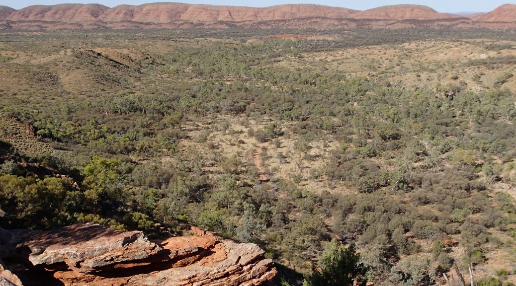
These few days of doing very minimal flew by and it wasn’t too long until we were off to our next destination.  There was only one small pocket of national park close to Alice we hadn’t yet explored, Owen Springs.  Only 45 minutes back south down the Stuart Hwy we made it to the turn off.  Name sounds promising, tourist information said there were water holes, the pamphlet even stated “water holes”.  To our demise we found no such signs of water but rather the contrary, we camped in the river bed itself.  Totally remote and only wildlife around us in the outback, even with no water we had ourselves a blast with a fire and homemade cheese/herb damper (getting experimental now!).  Cruising through the rest of the national park was rather disapointing as the brochure also stated points of interest alog the way.  Only 2 of 9 were actually signposted which was the first homestead built in the NT and an old Aboriginal dwelling where they lived when working on the station which included a small tin shed to sleep in, a shower shed and outhouse.

image

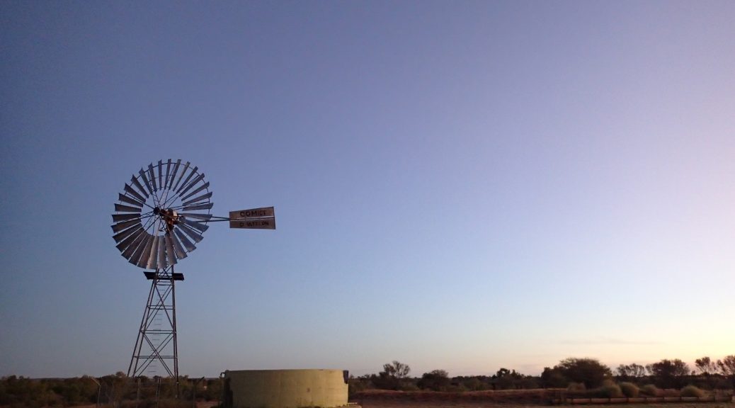
Finding ourselves back on the hwy north of Alice we were heading toward Tennant Creek.  We stayed at another couple of overnight camps thanks to Wiki Camps and Nay.  Maybe make that one of two as the first night every road train that passed would wake you up, a train with a solid number of 30 carriages passed and to top it off a mindmill no more than 20m away from the tent made a loud “clunk” as it was blowing gracefully in the wind.  On this stretch of the highway we were also able to explore the Devil’s Marbles (Karlu Karlu).  We would definitely suggest now to travel central Australia north to south.  As impressive as these granite marvels are, the sheer magnitude of Uluru was uncomparable and too fresh in our memories.

image

Making it to Tennant Creek we had another relaxing day by their man made oasis in the desert, Lake Mary Ann.  This was one of the first days we hadn’t planned a walk or any sight seeing, and it felt wonderful to just swim in the water and lay in the sun with a good book..

Along the MacDonnell Ranges

As we drove into the far west end of the MacDonnell Ranges, the scenery before our eyes changed again.  The landscape was filled with a variety of greens and mountain ranges coated in spinifex, had formed on either side of the highway.  Now, we had both learnt a lot about spinifex over the information boards we read, a very interesting plant which thrives in desert conditions and has a root system 10m deep so it could reach a suitable water source.  All kinds of wildlife are dependant on these plants for shelter and protection in their day to day lives.  The first night we dropped in on a riverbed camp spot where we met another two couples.  We enjoyed some delightful beverages in front of the fire and shared stories from the past and future adventures we were to experience.  Lets not lie… it did get a little out of control!
A local spinifex shrub and its MacDonnell Ranges habitat

image

As an overall sum up of the ranges, you would call it a “mixed bag” of adventures.  We spent a good few days in here and each gorge or site had things to do for everyone.  Starting at the far west end we had Redbank Gorge.  We were informed by the info sign to bring an inflatable mattress to enjoy the float down the gorge.  Not knowing what to expect we reluctantly spent 15 mins in stinking hot weather blowing up the lilo.  Then carrying the lilo for further 20 minute walk in, we hoped it was worth it.  Well it was!  We spent a good 45 mins – 1hr floating down the beautiful gorge where some areas were as narrow as 600mm and others as wide as a car.  Light trickled in to bounce off spectacular cuts in the cliff edges which were a variety of colours.  We  also passed many a happy (We all know frogs go “La Di Da Di Da!!”) and well camouflaged frogs along the way.  Starting to get bloody cold we had to turn back with the unknown of how far the gorge would last..

image

As we traveled further east we dropped in on a few sandy gorges with great big waterholes.  Others were just lovely walking tracks to smaller gorges and an abundance of other treks from there.  Each turn off down the main drag was also scattered with history and local knowledge of what the place means to the Aboriginal people.  An example of this were the Ochre Pits.  A short 300m walk to the info board and it had all the knowledge on a substance we never knew existed.  Mined in only a few places around Australia (including the MacDonnell Ranges), Ochre is still used today in many traditional ways including medicinal needs and body paint.  After writing words on rocks and drawing on each other with this chalk like substance, we moved on to the next place of mystery.

image

As we headed towards the far east end getting closer to Alice Springs we came across more luxurious hideaways, deep water holes and little slices of paradise.  You could easily forget you were once driving through a baron desert..

A bumpy trip to Palm Valley

As we departed our camp dingo friends, the road was rough ahead.  Just under 2 hours of driving on an unsealed corrugated mess, we found ourselves at the Aboriginal community of Hermannsburg which was the site of the old Lutheran mission.  This was a rather large culture shock.  We had a tour through the historical grounds from back in the late 1800s.  The purpose of this mission was to intergrate natives into white culture.  This was also the place where the famous aboriginal artist Albert Namatjira grew up and marked his place in history. After the tour, we went to the local supermarket to buy a loaf of bread (which we’d been longing for since Coober Pedy!) and was actually reasonably priced, unlike the diesal at $2.37c/L!!

A blackboard from the school at the mission

image

We continued our trip back down the road onto a “4WD only” track that headed toward Palm Valley.  This path followed a similar suit to the one earlier that day although some sand and dried up river beds made it entertaining.  Making it to the camp site just before the Valley we bunkered down and relaxed by the Finke River and had hot showers!  We had heard mixed stories about the last of the 4×4 path into the Valley itself and weather or not it was only taken by experienced drivers, otherwise we’d have to walk an extra 8km.  So stragically having dinner at the communal kitchen we striked up a convo with some other campers in regards to the matter.  Mixed opinions all round!  “Definitely need to be very experienced!”, “Need high clearance.”, “Nah you’ll be right mate.” and “You’ll have fun! Just go over and down all the boulders!” was the talk of the kitchen.  Our unsettled minds went to bed thinking what the hell..lets give it a crack in the morning..

The next day lead to more fun and adventure!  Waking up we made our way down the unknown track into the Valley.  Low range and a nice slow pace, we navigated through some contraversial landscapes to find ourselves out the other side and into a gorgeous Valley filled with Red Cabbage Palms. These palms grow only in very particular areas around Australia and if all were put together around the country it would fill a small area of 1 square km.  A 5km walk lead us around the top edge of the Valley to gain an oversite of the entire place and its magic.  This then lead back down where we were taken among the palms and along the riverbed.

image

Back at the car we made our way down the track in which we came for a bumby yet exhillirating exit.  As we made our way back on the riverbed track we came to a halt as a member of the grey army had his caravan bogged to the axles in sand.  A learning curb for us, yet a trying time for another couple who had been with him for over an hour before we arrived, we attemped to get him back on the road.  Working with this old timer who didn’t want a bar of anyones advice, what took another hour after four more cars piled up, he managed to get some distance untill he was back on solid ground.  From here we had a clear path ahead to the Macdonnel Ranges..

image

Exploration of a King!

As the adventure continued from Uluru, we once again made it back on the highway up north to our next destination, Kings Canyon. We camped in another excellent bushcamp rest area (starting to realise NT dominate in this market) where once again had unwanted neighbours drop in on us. All set up facing what we thought was the bush, a family decided to roll up late and camp about 5m right in front of us on the side of a track and ruined our privacy. While we were trying to eat our romantic dinner for two, one of the kids decided to shine his torch right in our faces which obviously the parents thought was fine! On a good note, we were able to use our shower tent and had the first battery powered shower for the trip!

The next day brought the exploration of Kings Canyon. In the morning, after ducking into Kathleen Springs for a stroll down the beautiful and historically rich valley to see the old stockade, we made a late arrival at Kings Canyon. Full spirited we began the 6.7km walk (not reccommended at this stage of the day!) up and along the rim of the Canyon. Absolutely spectacular. The walk took us up and along cliffs, down the valley, into the peaceful Garden of Eden (rainforest like waterhole), and back along the opposing side until we were lead back to the carpark. I don’t think we could of finished the last of the trip quick enough. As we were approaching 3:00pm we were buggered, smashing through the kms, guzzling as much water as we could and wiping the sweat off our brows. Even with a difficult conclusion, we conquered it with smiles and could only laugh at the end with recommendations to never start a walk that large, that late in the day.

2016-04-24_22.09.12

Interesting Historic Fact..

The palm in this below picture is somewhere between 350-400 years old!! These Cycads were scientifically proven to be around back in the dinosaur age!

OLYMPUS DIGITAL CAMERA

Once we had a few lolly snakes and recovered, we jumped in the car and made it to the servo before the Mereenie Loop (an unsealed road joining Kings Canyon, Hermannsburg and the MacDonnell Ranges). This is unfortunately a permit road as it is on Aboriginal Country. We decided the $5.50 for the permit was a lot cheaper than a $1000 fine if caught without one!! We ended up camping at Morris Pass Lookout which is situated on the Aboriginal section of the loop. As we arrived we were welcomed by a couple of friendly dingoes which happily wandered around the camp, sussing our kettle out during the night (see paw print on the table) and giving us the occasional howl. Now, the land here was phenomenal, so untouched as we sat with a 1.25L bottle of coke, some Bacardi and Jim Beam. Tough as it sounds we sat on a cliff, drinks in hand, and watched the sun set, with the all mighty Kings Canyon off in the distance..

2016-04-24_22.23.21.jpg

The Big Red Rock, Uluru!

After waking up at Agnus Creek we made it back on the road toward Uluru.  We hit the border soon after we left only to take a selfie posing on the sign.  Once across the border we knew the rock was close by, the landscape around us was changing to a deeper red and the sand dunes were phenomenal (nothing like the white sands back home!).  A quick pull over to the side of the road and we bagged ourselves some red sand!  Another landmark along this track was another mass of rock which has been mistaken to be Uluru by many a tourist (even an asian tourist which seemed very excited when we pulled up to the lookout), it was Mt Conner.

image

After a busy day of driving and shenanigans, we decided to pull into a camp spot about an hour from Uluru by the name of Curtain Springs.  Here we fended off a swarm of flies before really relaxing to a book and seeing the evening out for an early night in bed as the next morning we were to be up at the crack of dawn..

The next morning we were off!  Straight down the highway to see Uluru just as the sun was rising.  We went through the park gates and bam, the rock was in our sights. Totally awe inspiring to say the least, and it only got better and better as we approached closer and closer.  Once at the base of the great land mass of Uluru, we achieved the 10.6km base walk which gave us an even greater sight of the great beast in all of its glory.

Once we had returned from our walk we crept over to the sunset carpark and had a lazy afternoon while waiting for the sun to set.  As sun down was upon us the parking lot turned into a mass of cars and other tourists.  Everyone gathered around to see what Uluru had in store for us next.  As we again clumbered on the roofracks with a beer in tow, we sat and admired the view.  “Out of this world” would be a good way to put it with the shots on the left of the next collage.  As the sun set, colours changed, starting from a dull red, to yellow, to a dark dull red, to a vivid stunning blood orange.

We then tucked ourselves in a free bush camp 15 minutes from the park where we reflected on the massive day passed.

image

The next day we made our way back into the park to visit another large formation of rocks known to the Aboriginals as Kata Tjuta.  We completed the 7.4km walk around this great landscape of rocks in a different form being it was very rocky and uneven terrain as it guided you through the sacred “domes” of the native tribe.  As you can tell by the fly nets (best seven bucks anyone would spend!) it seemed like there was a plague.  Even with this difficult path and trying conditions we managed to make it around and see the wonders KataTjuta had to offer.  Some might even of said these are as or even more impressive than Uluru itself..

image